
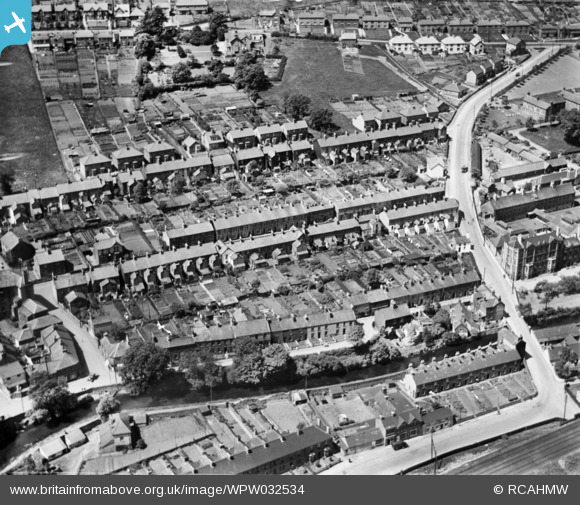
WPW032534 WALES (1930). General view of Griffithstown, oblique aerial view. 5"x4" black and white glass plate negative.
© Copyright OpenStreetMap contributors and licensed by the OpenStreetMap Foundation. 2026. Cartography is licensed as CC BY-SA.
Nearby Images (2)
WPW032534

WPW032535

Details
| Title | [WPW032534] General view of Griffithstown, oblique aerial view. 5"x4" black and white glass plate negative. |
| Reference | WPW032534 |
| Date | 1930 |
| Link | Coflein Archive Item 6370812 |
| Place name | |
| Parish | |
| District | |
| Country | WALES |
| Easting / Northing | 329370, 198970 |
| Longitude / Latitude | -3.0217794832574, 51.68458023218 |
| National Grid Reference | ST294990 |
Pins

Bloodthorn |
Tuesday 11th of December 2012 02:16:58 PM | |
|
Pepper |
Thursday 28th of June 2012 02:11:09 PM | |

barney rubble |
Thursday 28th of June 2012 10:20:05 AM |