
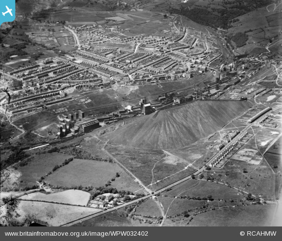
WPW032402 WALES (1930). View of Bargoed colliery looking from SE, oblique aerial view. 5"x4" black and white glass plate negative.
© Copyright OpenStreetMap contributors and licensed by the OpenStreetMap Foundation. 2026. Cartography is licensed as CC BY-SA.
Nearby Images (3)
WPW032400

WPW032402

WPW032403

Details
| Title | [WPW032402] View of Bargoed colliery looking from SE, oblique aerial view. 5"x4" black and white glass plate negative. |
| Reference | WPW032402 |
| Date | 7-June-1930 |
| Link | Coflein Archive Item 6370723 |
| Place name | |
| Parish | |
| District | |
| Country | WALES |
| Easting / Northing | 314000, 199000 |
| Longitude / Latitude | -3.2440878432945, 51.682705855069 |
| National Grid Reference | ST140990 |
Pins

Bill Smith |
Wednesday 12th of November 2014 05:07:24 PM | |
|
Bill Smith |
Wednesday 12th of November 2014 05:02:15 PM | |
|
johnabutt |
Tuesday 10th of July 2012 10:04:12 PM | |
|
johnabutt |
Tuesday 10th of July 2012 10:03:22 PM | |
|
johnabutt |
Tuesday 10th of July 2012 10:02:27 PM | |
|
johnabutt |
Tuesday 10th of July 2012 10:00:50 PM | |
|
Reg Malpass |
Thursday 28th of June 2012 10:43:18 AM | |
Hi there. This was Bargoed powerhouse and cooling towers. |
Bill Smith |
Wednesday 12th of November 2014 05:08:38 PM |
|
johnabutt |
Wednesday 27th of June 2012 11:01:23 PM |