
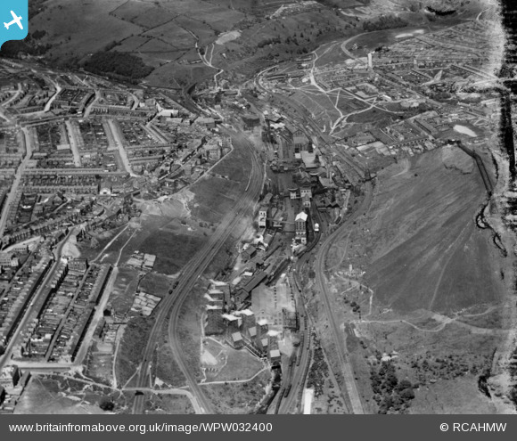
WPW032400 WALES (1930). View of Bargoed colliery looking from south, oblique aerial view. 5"x4" black and white glass plate negative.
© Copyright OpenStreetMap contributors and licensed by the OpenStreetMap Foundation. 2026. Cartography is licensed as CC BY-SA.
Nearby Images (3)
WPW032400

WPW032402

WPW032403

Details
| Title | [WPW032400] View of Bargoed colliery looking from south, oblique aerial view. 5"x4" black and white glass plate negative. |
| Reference | WPW032400 |
| Date | 7-June-1930 |
| Link | Coflein Archive Item 6370722 |
| Place name | |
| Parish | |
| District | |
| Country | WALES |
| Easting / Northing | 314000, 199000 |
| Longitude / Latitude | -3.2440878432945, 51.682705855069 |
| National Grid Reference | ST140990 |
Pins

MPMunro |
Wednesday 13th of March 2024 02:08:07 PM | |

Class31 |
Friday 5th of October 2012 02:01:45 PM | |
|
Class31 |
Friday 5th of October 2012 02:01:03 PM | |
|
Class31 |
Friday 5th of October 2012 01:59:42 PM | |
|
Class31 |
Friday 5th of October 2012 01:59:06 PM | |
|
Class31 |
Friday 5th of October 2012 01:58:40 PM | |
|
Class31 |
Friday 5th of October 2012 01:56:17 PM |
User Comment Contributions
My former home town. I lived at Gladstone villa. I was there with my family from 1969 to 1978 until Ricci's baught the property and it was renamed Park Villa's before it became Reds park hotel, this itself is now closed down. |
Andrew Dexter |
Sunday 30th of April 2017 11:57:16 AM |