
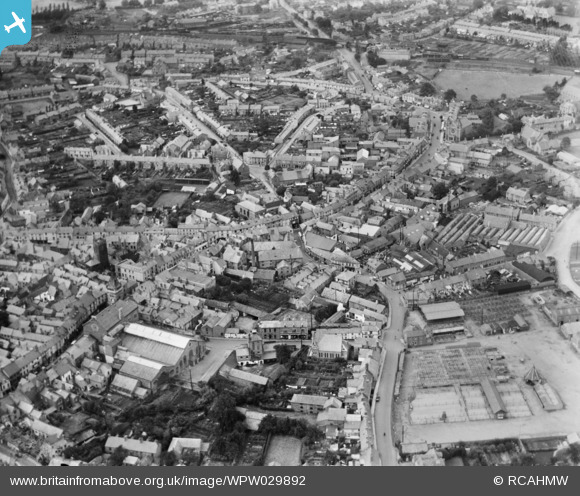
WPW029892 WALES (1929). General view of Abergavenny, oblique aerial view. 5"x4" black and white glass plate negative.
© Copyright OpenStreetMap contributors and licensed by the OpenStreetMap Foundation. 2026. Cartography is licensed as CC BY-SA.
Nearby Images (30)
WAW000674

WAW000675

WAW000676

WAW000677

WAW000678

WAW000679

WAW000680

WAW000681

WAW026200

WAW026201

WAW026202

WAW026203

WAW026204

WAW026205

WPW029891

WPW029892

WPW029893

WPW029897

WPW029898

WPW029899

WPW029900

WPW029901

WPW029909

WPW029950

WPW029976

WPW039965

WPW039966

WPW039967

WPW039968

WPW039969

Details
| Title | [WPW029892] General view of Abergavenny, oblique aerial view. 5"x4" black and white glass plate negative. |
| Reference | WPW029892 |
| Date | 1929 |
| Link | Coflein Archive Item 6370692 |
| Place name | |
| Parish | |
| District | |
| Country | WALES |
| Easting / Northing | 329833, 214333 |
| Longitude / Latitude | -3.0181841706239, 51.822762430277 |
| National Grid Reference | SO298143 |
Pins

Beccy |
Wednesday 21st of September 2016 01:09:49 PM | |
|
John Ellis |
Friday 13th of September 2013 07:58:16 PM | |
|
John Ellis |
Friday 13th of September 2013 07:57:03 PM | |
|
Stewart Lawrie |
Friday 6th of July 2012 02:55:06 PM | |
There was a 'goods shed' and some LNWR/LMS administrative buildings on the south side of the tracks. The main sidings were to the south of Brecon Road |
Western Road |
Friday 16th of November 2012 10:56:16 PM |

Class31 |
Tuesday 3rd of July 2012 05:40:01 PM | |
|
Class31 |
Tuesday 3rd of July 2012 05:39:23 PM | |
|
Class31 |
Tuesday 3rd of July 2012 05:38:54 PM | |
|
Class31 |
Tuesday 3rd of July 2012 05:37:57 PM | |
|
Bloodthorn |
Thursday 28th of June 2012 04:26:53 PM | |
|
Bloodthorn |
Thursday 28th of June 2012 04:25:36 PM | |
|
Bloodthorn |
Thursday 28th of June 2012 04:25:06 PM |