
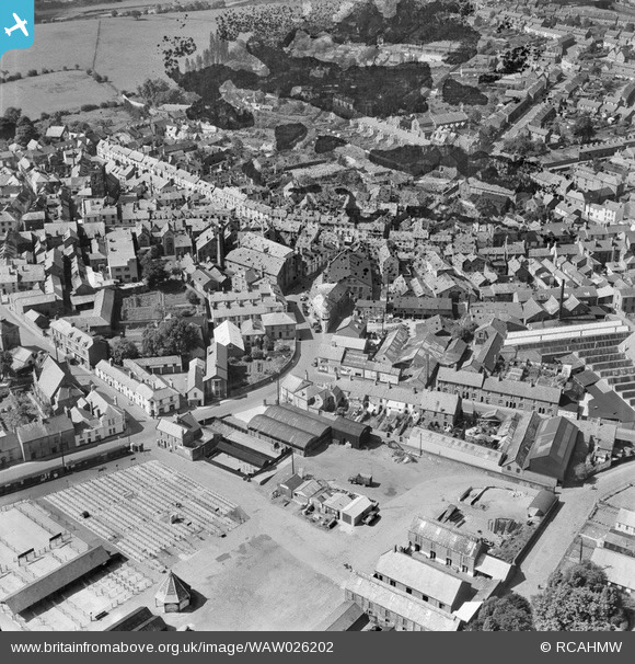
WAW026202 WALES (1949). View of Abergavenny showing cattle market
© Copyright OpenStreetMap contributors and licensed by the OpenStreetMap Foundation. 2026. Cartography is licensed as CC BY-SA.
Nearby Images (30)
WAW000674

WAW000675

WAW000676

WAW000677

WAW000678

WAW000679

WAW000680

WAW000681

WAW026200

WAW026201

WAW026202

WAW026203

WAW026204

WAW026205

WPW029891

WPW029892

WPW029893

WPW029897

WPW029898

WPW029899

WPW029900

WPW029901

WPW029909

WPW029950

WPW029976

WPW039965

WPW039966

WPW039967

WPW039968

WPW039969

Details
| Title | [WAW026202] View of Abergavenny showing cattle market |
| Reference | WAW026202 |
| Date | 12-August-1949 |
| Link | Coflein Archive Item 6414138 |
| Place name | |
| Parish | |
| District | |
| Country | WALES |
| Easting / Northing | 329833, 214333 |
| Longitude / Latitude | -3.0181841706239, 51.822762430277 |
| National Grid Reference | SO298143 |
Pins

Billy Turner |
Thursday 12th of January 2017 08:03:44 PM | |

Class31 |
Monday 6th of April 2015 07:56:45 AM |


User Comment Contributions

Frogmore Street, 24/08/2013 |
Class31 |
Monday 6th of April 2015 07:57:07 AM |