
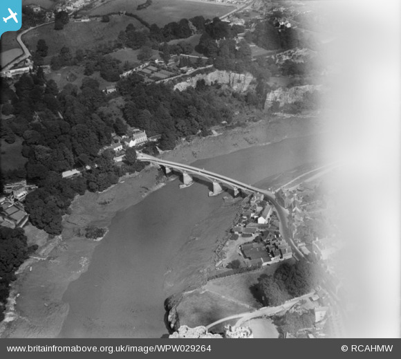
WPW029264 WALES (1929). View of Chepstow showing Chepstow Bridge, oblique aerial view. 5"x4" black and white glass plate negative.
© Copyright OpenStreetMap contributors and licensed by the OpenStreetMap Foundation. 2026. Cartography is licensed as CC BY-SA.
Nearby Images (32)
WAW006533

WAW006536

WAW006538

WAW006539

WAW007099

WAW007100

WAW007101

WAW013222

WAW013223

WAW013224

WAW013225

WAW013226

WAW013227

WAW018018

WAW018019

WAW018020

WAW027431

WAW027432

WAW052877

WAW052878

WPW006062

WPW006063

WPW006065

WPW029261

WPW029263

WPW029264

WPW029265

WPW029266

WPW029268

WPW029269

WPW029272

WPW029273

Details
| Title | [WPW029264] View of Chepstow showing Chepstow Bridge, oblique aerial view. 5"x4" black and white glass plate negative. |
| Reference | WPW029264 |
| Date | 1929 |
| Link | Coflein Archive Item 6378103 |
| Place name | |
| Parish | |
| District | |
| Country | WALES |
| Easting / Northing | 354000, 194000 |
| Longitude / Latitude | -2.6648442993575, 51.642450404753 |
| National Grid Reference | ST540940 |
Pins
Be the first to add a comment to this image!
User Comment Contributions

England 01/03/2014 |

Class31 |
Sunday 2nd of March 2014 11:50:50 AM |

Chepstow Bridge from Chepstow Castle 01/3/2014 |
Class31 |
Sunday 2nd of March 2014 11:45:20 AM |

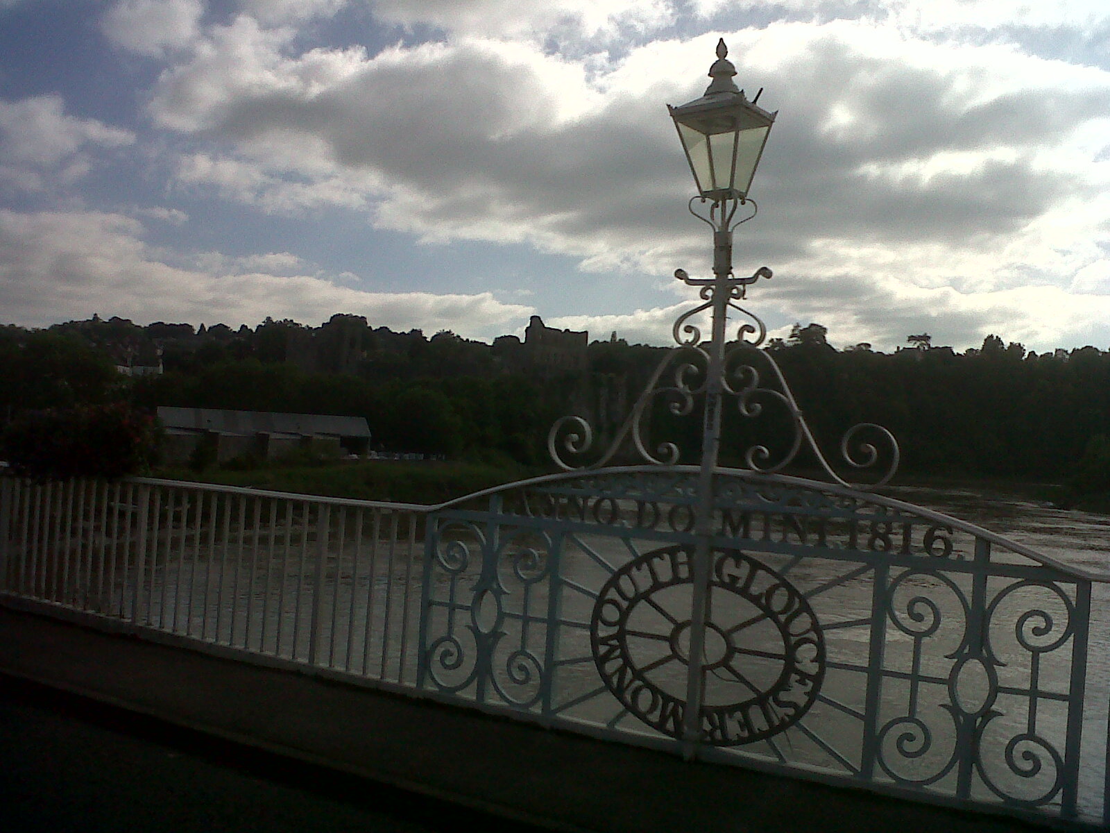
Chepstow Bridge |
Class31 |
Sunday 21st of July 2013 10:28:55 AM |
View towards the castle from Chepstow Bridge |
Class31 |
Sunday 21st of July 2013 10:27:48 AM |
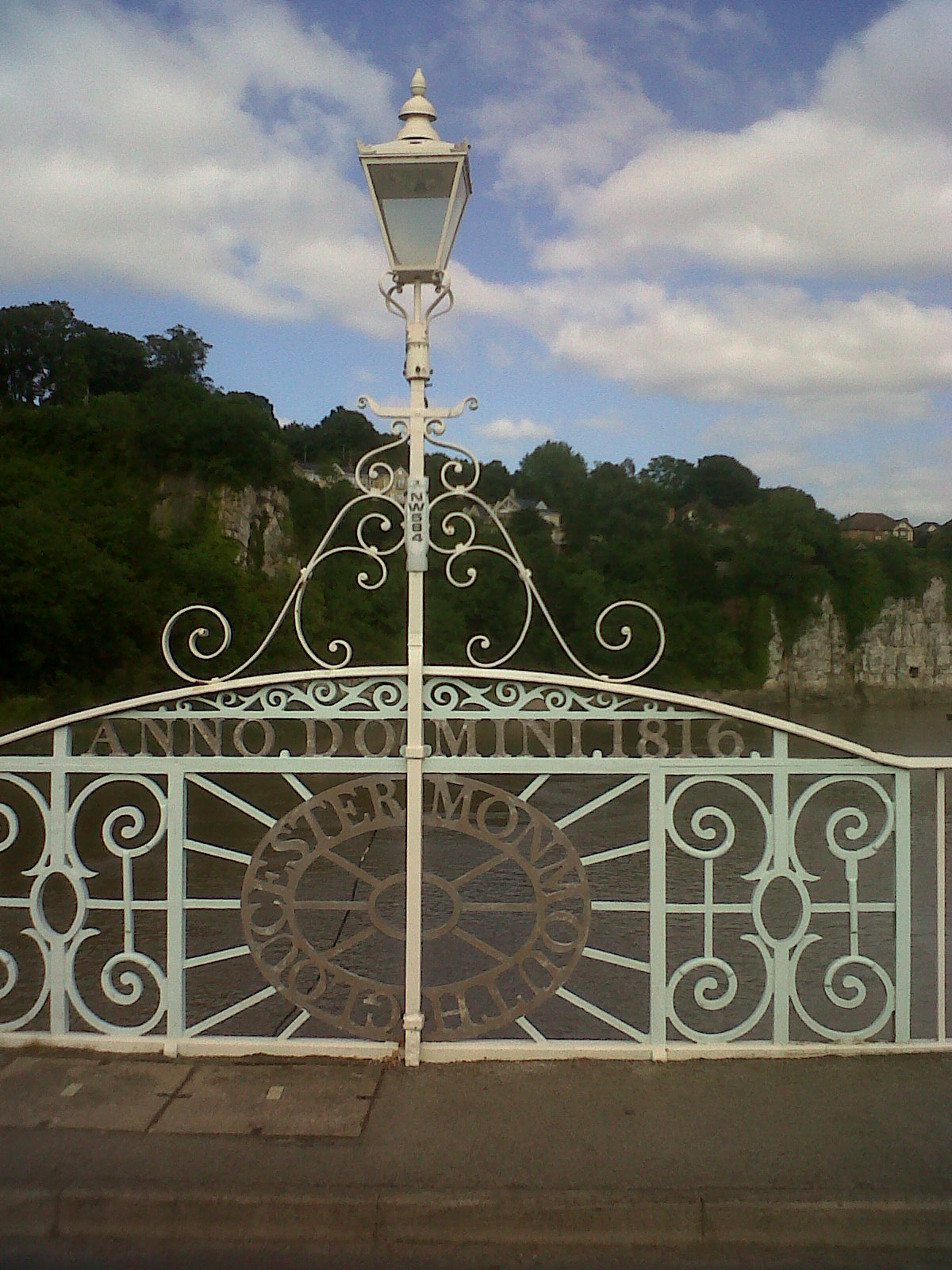
Detail on Chepstow Bridge |
Class31 |
Sunday 21st of July 2013 09:35:04 AM |