
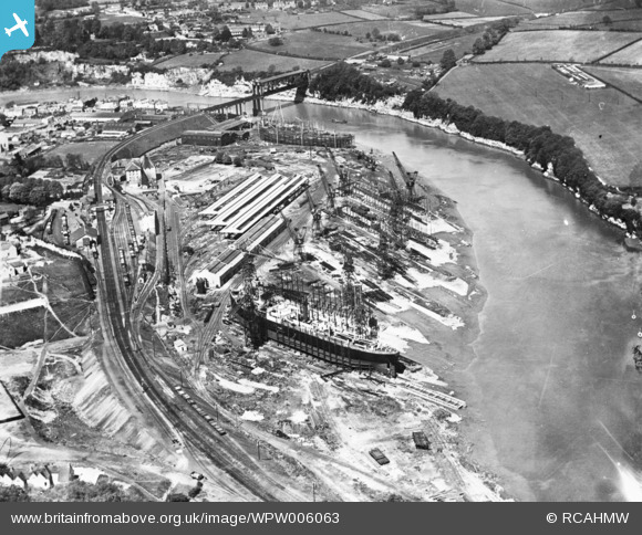
WPW006063 WALES (1921). View of Chepstow showing ship building in the National Ship Yard, engineering works and tubular suspension bridge. Oblique aerial photograph.
© Copyright OpenStreetMap contributors and licensed by the OpenStreetMap Foundation. 2026. Cartography is licensed as CC BY-SA.
Nearby Images (32)
WAW006533

WAW006536

WAW006538

WAW006539

WAW007099

WAW007100

WAW007101

WAW013222

WAW013223

WAW013224

WAW013225

WAW013226

WAW013227

WAW018018

WAW018019

WAW018020

WAW027431

WAW027432

WAW052877

WAW052878

WPW006062

WPW006063

WPW006065

WPW029261

WPW029263

WPW029264

WPW029265

WPW029266

WPW029268

WPW029269

WPW029272

WPW029273

Details
| Title | [WPW006063] View of Chepstow showing ship building in the National Ship Yard, engineering works and tubular suspension bridge. Oblique aerial photograph. |
| Reference | WPW006063 |
| Date | 1921 |
| Link | Coflein Archive Item 6422609 |
| Place name | |
| Parish | |
| District | |
| Country | WALES |
| Easting / Northing | 354000, 194000 |
| Longitude / Latitude | -2.6648442993575, 51.642450404753 |
| National Grid Reference | ST540940 |
Pins

gBr |
Saturday 10th of October 2015 07:36:17 PM | |
|
MB |
Tuesday 14th of October 2014 06:28:11 PM | |
|
MB |
Tuesday 14th of October 2014 06:25:05 PM |