
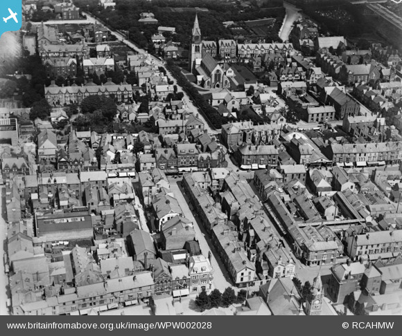
WPW002028 WALES (1920). View of Rhyl showing town, oblique aerial view. 5"x4" black and white glass plate negative.
© Copyright OpenStreetMap contributors and licensed by the OpenStreetMap Foundation. 2026. Cartography is licensed as CC BY-SA.
Nearby Images (48)
WAW023323

WAW023324

WAW023325

WAW023326

WAW024734

WAW024735

WAW024736

WAW024737

WAW024738

WAW024739

WPW002012

WPW002013

WPW002014

WPW002015

WPW002016

WPW002018

WPW002019

WPW002020

WPW002021

WPW002022

WPW002023

WPW002024

WPW002025

WPW002026

WPW002027

WPW002028

WPW002029

WPW002031

WPW002032

WPW002034

WPW040144

WPW040145

WPW040146

WPW040147

WPW040148

WPW040149

WPW040150

WPW045181

WPW045182

WPW045183

WPW045184

WPW045185

WPW051608

WPW051609

WPW055740

WPW055741

WPW055742

WPW055743

Details
| Title | [WPW002028] View of Rhyl showing town, oblique aerial view. 5"x4" black and white glass plate negative. |
| Reference | WPW002028 |
| Date | July-1920 |
| Link | Coflein Archive Item 6370236 |
| Place name | |
| Parish | |
| District | |
| Country | WALES |
| Easting / Northing | 300865, 381430 |
| Longitude / Latitude | -3.4884193458625, 53.320230803048 |
| National Grid Reference | SJ009814 |
Pins
Be the first to add a comment to this image!