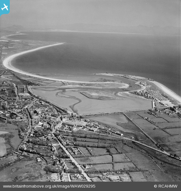
WAW029295 WALES (1950). General view of Pwllheli
© Copyright OpenStreetMap contributors and licensed by the OpenStreetMap Foundation. 2026. Cartography is licensed as CC BY-SA.
Nearby Images (13)
Details
| Title | [WAW029295] General view of Pwllheli |
| Reference | WAW029295 |
| Date | 1950 |
| Link | Coflein Archive Item 6414199 |
| Place name | |
| Parish | |
| District | |
| Country | WALES |
| Easting / Northing | 237425, 335193 |
| Longitude / Latitude | -4.416750686082, 52.889254290467 |
| National Grid Reference | SH374352 |
Pins
Be the first to add a comment to this image!


![[WAW029293] General view of Pwllheli](http://britainfromabove.org.uk/sites/all/libraries/aerofilms-images/public/100x100/WAW/029/WAW029293.jpg)
![[WAW029294] General view of Pwllheli](http://britainfromabove.org.uk/sites/all/libraries/aerofilms-images/public/100x100/WAW/029/WAW029294.jpg)
![[WAW029295] General view of Pwllheli](http://britainfromabove.org.uk/sites/all/libraries/aerofilms-images/public/100x100/WAW/029/WAW029295.jpg)
![[WAW029296] General view of Pwllheli](http://britainfromabove.org.uk/sites/all/libraries/aerofilms-images/public/100x100/WAW/029/WAW029296.jpg)
![[WPW045215] View of Pwllheli showing promenade, oblique aerial view. 5"x4" black and white glass plate negative.](http://britainfromabove.org.uk/sites/all/libraries/aerofilms-images/public/100x100/WPW/045/WPW045215.jpg)
![[WPW045216] View of Pwllheli showing promenade and recreation ground, oblique aerial view. 5"x4" black and white glass plate negative.](http://britainfromabove.org.uk/sites/all/libraries/aerofilms-images/public/100x100/WPW/045/WPW045216.jpg)
![[WPW045217] View of Pwllheli showing promenade and recreation ground, oblique aerial view. 5"x4" black and white glass plate negative.](http://britainfromabove.org.uk/sites/all/libraries/aerofilms-images/public/100x100/WPW/045/WPW045217.jpg)
![[WPW045218] View of Pwllheli showing promenade and recreation ground, oblique aerial view. 5"x4" black and white glass plate negative.](http://britainfromabove.org.uk/sites/all/libraries/aerofilms-images/public/100x100/WPW/045/WPW045218.jpg)
![[WPW045219] View of Pwllheli showing promenade and recreation ground, oblique aerial view. 5"x4" black and white glass plate negative.](http://britainfromabove.org.uk/sites/all/libraries/aerofilms-images/public/100x100/WPW/045/WPW045219.jpg)
![[WPW045220] View of landscape (Penrhos and Carreg y Defaid) near Pwllheli, oblique aerial view. 5"x4" black and white glass plate negative.](http://britainfromabove.org.uk/sites/all/libraries/aerofilms-images/public/100x100/WPW/045/WPW045220.jpg)
![[WPW045221] View of landscape (Penrhos and Carreg y Defaid) near Pwllheli, oblique aerial view. 5"x4" black and white glass plate negative.](http://britainfromabove.org.uk/sites/all/libraries/aerofilms-images/public/100x100/WPW/045/WPW045221.jpg)
![[WPW045222] View of landscape (Penrhos and Carreg y Defaid) near Pwllheli, oblique aerial view. 5"x4" black and white glass plate negative.](http://britainfromabove.org.uk/sites/all/libraries/aerofilms-images/public/100x100/WPW/045/WPW045222.jpg)
![[WPW045223] View of landscape (Penrhos and Carreg y Defaid) near Pwllheli, oblique aerial view. 5"x4" black and white glass plate negative.](http://britainfromabove.org.uk/sites/all/libraries/aerofilms-images/public/100x100/WPW/045/WPW045223.jpg)