
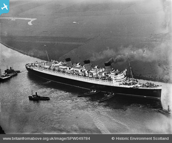
SPW049784 SCOTLAND (1936). Queen Mary, River Clyde, Clydebank. An oblique aerial photograph taken facing south.
© Copyright OpenStreetMap contributors and licensed by the OpenStreetMap Foundation. 2026. Cartography is licensed as CC BY-SA.
Nearby Images (22)
SPW019475

SPW049784

SPW049785

SPW049793

SPW049799

SPW053550

SAR008774

SAW024758

SPW045821

SPW045822

SPW045823

SPW048769

SPW048770

SPW048771

SPW053551

SAW024756

SPW040275

SPW052992

SPW052994

SPW052995

SPW053000

SPW053549

Details
| Title | [SPW049784] Queen Mary, River Clyde, Clydebank. An oblique aerial photograph taken facing south. |
| Reference | SPW049784 |
| Date | 1936 |
| Link | NRHE Collection item 1257784 |
| Place name | |
| Parish | OLD KILPATRICK (CLYDEBANK) |
| District | CLYDEBANK |
| Country | SCOTLAND |
| Easting / Northing | 249688, 669676 |
| Longitude / Latitude | -4.4041786178711, 55.896736965978 |
| National Grid Reference | NS497697 |
Pins
Be the first to add a comment to this image!