
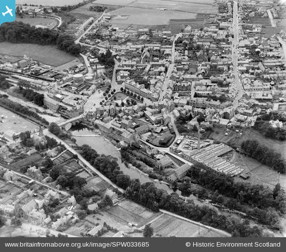
SPW033685 SCOTLAND (1930). Blairgowrie, general view, showing Wellmeadow and Perth Street. An oblique aerial photograph taken facing south.
© Copyright OpenStreetMap contributors and licensed by the OpenStreetMap Foundation. 2026. Cartography is licensed as CC BY-SA.
Nearby Images (7)
SPW033685

SPW020130

SPW020131

SPW020128

SPW020129

SPW033684

SPW033686

Details
| Title | [SPW033685] Blairgowrie, general view, showing Wellmeadow and Perth Street. An oblique aerial photograph taken facing south. |
| Reference | SPW033685 |
| Date | 1930 |
| Link | NRHE Collection item 1257034 |
| Place name | |
| Parish | BLAIRGOWRIE |
| District | PERTH AND KINROSS |
| Country | SCOTLAND |
| Easting / Northing | 317963, 745265 |
| Longitude / Latitude | -3.3360512062747, 56.592227746033 |
| National Grid Reference | NO180453 |
