
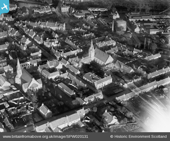
SPW020131 SCOTLAND (1927). Blairgowrie, general view, showing Union Street and South Free Church. An oblique aerial photograph taken facing east.
© Copyright OpenStreetMap contributors and licensed by the OpenStreetMap Foundation. 2026. Cartography is licensed as CC BY-SA.
Nearby Images (6)
SPW020131

SPW020130

SPW033684

SPW033685

SPW020129

SPW020128

Details
| Title | [SPW020131] Blairgowrie, general view, showing Union Street and South Free Church. An oblique aerial photograph taken facing east. |
| Reference | SPW020131 |
| Date | 1927 |
| Link | NRHE Collection item 1256182 |
| Place name | |
| Parish | BLAIRGOWRIE |
| District | PERTH AND KINROSS |
| Country | SCOTLAND |
| Easting / Northing | 317891, 745079 |
| Longitude / Latitude | -3.3371644278758, 56.590544415545 |
| National Grid Reference | NO179451 |
Pins

Big D |
Monday 29th of April 2013 03:32:05 PM |
