
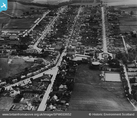
SPW033652 SCOTLAND (1930). Keith, general view, showing Land Street and Moss Street. An oblique aerial photograph taken facing south. This image has been produced from a print.
© Copyright OpenStreetMap contributors and licensed by the OpenStreetMap Foundation. 2026. Cartography is licensed as CC BY-SA.
Nearby Images (8)
SPW033652

SPW033653

SPW033651

SPW033655

SAR023875

SAR023876

SAR023877

SAR025574

Details
| Title | [SPW033652] Keith, general view, showing Land Street and Moss Street. An oblique aerial photograph taken facing south. This image has been produced from a print. |
| Reference | SPW033652 |
| Date | 1930 |
| Link | NRHE Collection item 1315485 |
| Place name | |
| Parish | KEITH |
| District | MORAY |
| Country | SCOTLAND |
| Easting / Northing | 343281, 850704 |
| Longitude / Latitude | -2.9476354609038, 57.543130872803 |
| National Grid Reference | NJ433507 |
Pins

Ralph Pomeroy |
Tuesday 1st of May 2018 12:20:29 PM | |
|
alba_gur_brath@btinternet.com |
Tuesday 2nd of January 2018 03:37:40 PM |