
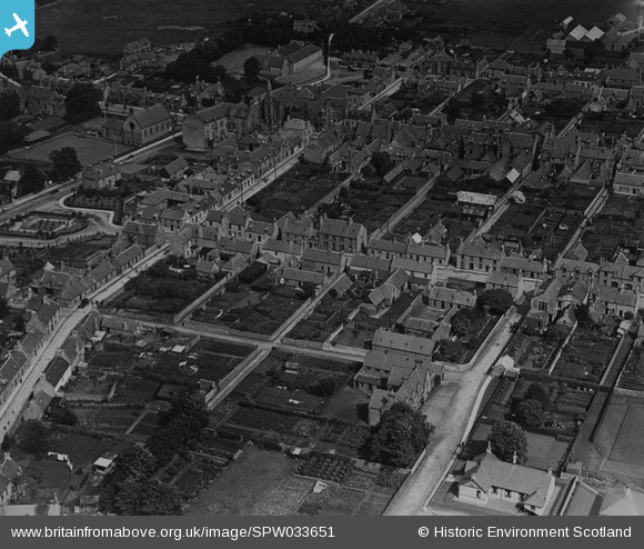
SPW033651 SCOTLAND (1930). Keith, general view, showing Land Street and Union Street. An oblique aerial photograph taken facing east. This image has been produced from a print.
© Copyright OpenStreetMap contributors and licensed by the OpenStreetMap Foundation. 2026. Cartography is licensed as CC BY-SA.
Nearby Images (8)
SPW033651

SPW033655

SPW033652

SPW033653

SAR023875

SAR023876

SAR023877

SAR025574

Details
| Title | [SPW033651] Keith, general view, showing Land Street and Union Street. An oblique aerial photograph taken facing east. This image has been produced from a print. |
| Reference | SPW033651 |
| Date | 1930 |
| Link | NRHE Collection item 1315484 |
| Place name | |
| Parish | KEITH |
| District | MORAY |
| Country | SCOTLAND |
| Easting / Northing | 343117, 850660 |
| Longitude / Latitude | -2.9503647809545, 57.542715062542 |
| National Grid Reference | NJ431507 |
Pins
Be the first to add a comment to this image!