
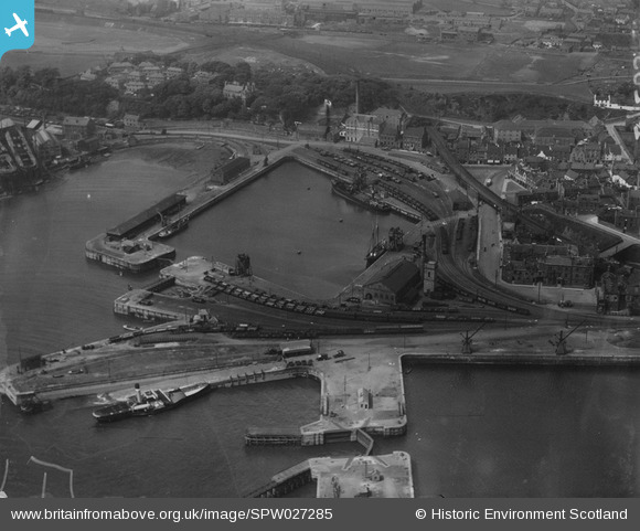
SPW027285 SCOTLAND (1929). Burntisland Harbour. An oblique aerial photograph taken facing north. This image has been produced from a marked print.
© Copyright OpenStreetMap contributors and licensed by the OpenStreetMap Foundation. 2026. Cartography is licensed as CC BY-SA.
Nearby Images (11)
SPW027186

SPW027285

SPW027183

SPW027288

SPW027524

SPW027283

SPW027184

SAR016801

SAR016802

SAR031683

SPW027188

Details
| Title | [SPW027285] Burntisland Harbour. An oblique aerial photograph taken facing north. This image has been produced from a marked print. |
| Reference | SPW027285 |
| Date | 1929 |
| Link | NRHE Collection item 1315413 |
| Place name | |
| Parish | BURNTISLAND |
| District | KIRKCALDY |
| Country | SCOTLAND |
| Easting / Northing | 323008, 685608 |
| Longitude / Latitude | -3.2364645977146, 56.057175093892 |
| National Grid Reference | NT230856 |
Pins
Be the first to add a comment to this image!