
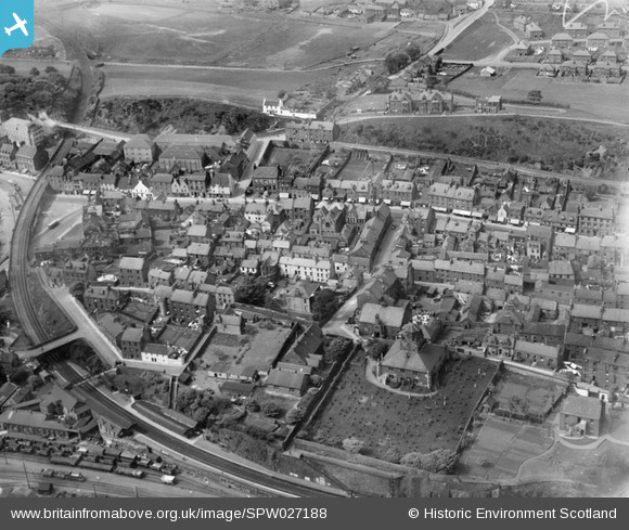
SPW027188 SCOTLAND (1929). Burntisland, general view, showing High Street and Burntisland Parish Church. An oblique aerial photograph taken facing north.
© Copyright OpenStreetMap contributors and licensed by the OpenStreetMap Foundation. 2026. Cartography is licensed as CC BY-SA.
Nearby Images (6)
SPW027188

SPW027187

SPW027283

SPW027186

SPW027285

SAR031684

Details
| Title | [SPW027188] Burntisland, general view, showing High Street and Burntisland Parish Church. An oblique aerial photograph taken facing north. |
| Reference | SPW027188 |
| Date | 1929 |
| Link | NRHE Collection item 1256762 |
| Place name | |
| Parish | BURNTISLAND |
| District | KIRKCALDY |
| Country | SCOTLAND |
| Easting / Northing | 323240, 685780 |
| Longitude / Latitude | -3.2327890321762, 56.058757532718 |
| National Grid Reference | NT232858 |
