
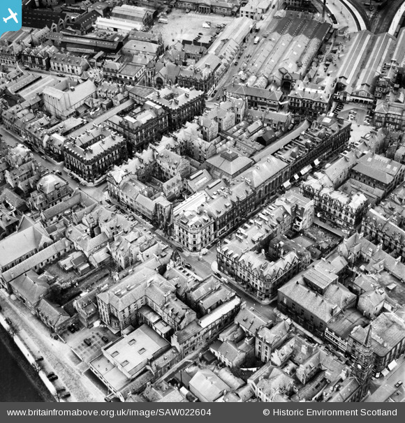
SAW022604 SCOTLAND (1949). Inverness, general view, showing Douglas Hotel, Union Street and Inverness Station. An oblique aerial photograph taken facing north.
© Copyright OpenStreetMap contributors and licensed by the OpenStreetMap Foundation. 2026. Cartography is licensed as CC BY-SA.
Nearby Images (22)
SAW022604

SAW022609

SAW022605

SAW022608

SAW022603

SAW022602

SPW040496

SAW022606

SAW022607

SAW022610

SAR016705

SPW022140

SPW040499

SPW022147

SPW033826

SPW022149

SAW003579

SPW022144

SAW019890

SPW022148

SPW022139

SAW019891

Details
| Title | [SAW022604] Inverness, general view, showing Douglas Hotel, Union Street and Inverness Station. An oblique aerial photograph taken facing north. |
| Reference | SAW022604 |
| Date | 1949 |
| Link | NRHE Collection item 1269033 |
| Place name | |
| Parish | INVERNESS AND BONA |
| District | INVERNESS |
| Country | SCOTLAND |
| Easting / Northing | 266624, 845341 |
| Longitude / Latitude | -4.2246662397843, 57.47888978868 |
| National Grid Reference | NH666453 |
Pins

Aliboy |
Monday 3rd of March 2014 10:34:19 PM |