
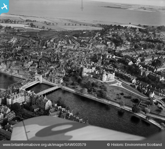
SAW003579 SCOTLAND (1947). Inverness, general view, showing Castle Hill and Inverness Station. An oblique aerial photograph taken facing north-east.
© Copyright OpenStreetMap contributors and licensed by the OpenStreetMap Foundation. 2026. Cartography is licensed as CC BY-SA.
Nearby Images (21)
SAW003579

SPW022144

SPW022148

SPW040500

SPW022149

SPW022146

SPW033826

SPW040499

SPW040498

SAW022606

SAW022607

SPW033829

SAW022609

SAW022605

SAW022608

SAW022604

SAW022603

SAW022602

SPW033833

SPW022145

SPW033825

Details
| Title | [SAW003579] Inverness, general view, showing Castle Hill and Inverness Station. An oblique aerial photograph taken facing north-east. |
| Reference | SAW003579 |
| Date | 1947 |
| Link | NRHE Collection item 1268500 |
| Place name | |
| Parish | INVERNESS AND BONA |
| District | INVERNESS |
| Country | SCOTLAND |
| Easting / Northing | 266636, 845116 |
| Longitude / Latitude | -4.2243434508875, 57.476873528558 |
| National Grid Reference | NH666451 |
Pins

Billy Turner |
Friday 23rd of April 2021 10:48:53 PM | |

gerry-r |
Monday 30th of June 2014 07:02:15 PM | |
|
gerry-r |
Monday 30th of June 2014 07:01:18 PM | |
|
McWhirter |
Thursday 2nd of August 2012 10:35:00 PM | |
|
mannidaze |
Tuesday 10th of July 2012 04:23:36 PM | |
Logan Construction did not utilise a wooden platform as can be seen in the series of photographs taken by Dr .William James Bethune: https://www.ambaile.org.uk/search/?searchQuery=New+Ness+Bridge+%233 |
rytenuff |
Friday 7th of August 2020 03:20:29 PM |

User Comment Contributions
The date appears might be incorrect. The image shows a temporary bridge South of Ness Bridge and what seems to be a platform with cranes for demolition of the old suspension bridge. The new bridge was built 1959/61 according to Pevsner. RCAHMS image Record ID 006-000-001-100-C Resource Rights Holder RCAHMS Date 18 May 1961 Shows the old bridge demolished and the temporary bridge South with a pedestrian bridge at the South side. This image is Record ID 006-019-000-002-C Resource Rights Holder RCAHMS Date Image Type Oblique As can be seen no date shown. The pedestrian bridge does not seem to have been added to the temporary bridge. No traffic is visible so not clear which bridge is in use. |

JMB |
Tuesday 26th of June 2012 12:13:47 AM |