
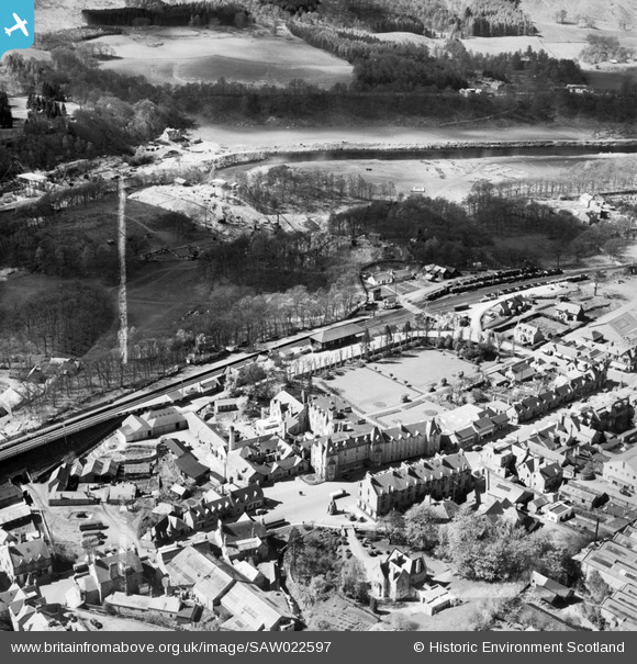
SAW022597 SCOTLAND (1949). Pitlochry, general view, showing Fisher's Hotel, Atholl Road and Pitlochry Station. An oblique aerial photograph taken facing west. This image has been produced from a crop marked negative.
© Copyright OpenStreetMap contributors and licensed by the OpenStreetMap Foundation. 2026. Cartography is licensed as CC BY-SA.
Nearby Images (19)
SAW022595

SAW022597

SAW022598

SAW022596

SAW022593

SAW022594

SAW022600

SAW032116

SAW032117

SAW032118

SAW032119

SAW032120

SAW032121

SAW022599

SAW022601

SPW040533

SAR016720

SAW051226

SAW051227

Details
| Title | [SAW022597] Pitlochry, general view, showing Fisher's Hotel, Atholl Road and Pitlochry Station. An oblique aerial photograph taken facing west. This image has been produced from a crop marked negative. |
| Reference | SAW022597 |
| Date | 1949 |
| Link | NRHE Collection item 1269025 |
| Place name | |
| Parish | MOULIN |
| District | PERTH AND KINROSS |
| Country | SCOTLAND |
| Easting / Northing | 293770, 758120 |
| Longitude / Latitude | -3.7351715345309, 56.702820423832 |
| National Grid Reference | NN938581 |
Pins
 |

Billy Turner |
Wednesday 2nd of March 2016 06:24:48 PM |
 |
Billy Turner |
Tuesday 1st of March 2016 04:19:30 PM |

MB |
Sunday 18th of November 2012 11:19:20 PM | |
|
MB |
Sunday 18th of November 2012 11:18:17 PM | |
|
MB |
Sunday 18th of November 2012 11:17:43 PM | |
|
MB |
Sunday 18th of November 2012 11:16:33 PM |
User Comment Contributions
The image shows the River Tummel hydro-electric scheme under construction beyond the town |
MB |
Sunday 18th of November 2012 11:13:50 PM |