
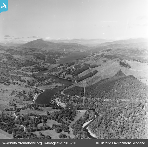
SAR016720 SCOTLAND (1952). Pitlochry, looking towards Loch Tummel from North/West of town of Pitlochry Moulin, Perthshire, Scotland. An oblique aerial photograph taken facing North/West.
© Copyright OpenStreetMap contributors and licensed by the OpenStreetMap Foundation. 2026. Cartography is licensed as CC BY-SA.
Nearby Images (16)
SAR016720

SAW022601

SAW022595

SAW022597

SAW022598

SAW022599

SAW022593

SAW022594

SAW022596

SAW022600

SAW032116

SAW032117

SAW032118

SAW032119

SAW032120

SAW032121

Details
| Title | [SAR016720] Pitlochry, looking towards Loch Tummel from North/West of town of Pitlochry Moulin, Perthshire, Scotland. An oblique aerial photograph taken facing North/West. |
| Reference | SAR016720 |
| Date | 1952 |
| Link | NRHE Collection item 1437978 |
| Place name | |
| Parish | MOULIN |
| District | PERTH AND KINROSS |
| Country | SCOTLAND |
| Easting / Northing | 293650, 758310 |
| Longitude / Latitude | -3.7372092406227, 56.704499433734 |
| National Grid Reference | NN937583 |
Pins
Be the first to add a comment to this image!