
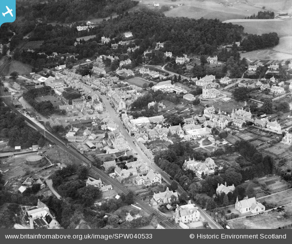
SPW040533 SCOTLAND (1932). Pitlochry, general view, showing Atholl Road and Pitlochry Station. An oblique aerial photograph taken facing north.
© Copyright OpenStreetMap contributors and licensed by the OpenStreetMap Foundation. 2026. Cartography is licensed as CC BY-SA.
Nearby Images (19)
SPW040533

SAW022593

SAW022594

SAW022600

SAW032116

SAW032117

SAW032118

SAW032119

SAW032120

SAW032121

SAW022599

SAW051226

SAW022596

SAW022595

SAW022597

SAW022598

SAW051227

SAW022601

SAR016716

Details
| Title | [SPW040533] Pitlochry, general view, showing Atholl Road and Pitlochry Station. An oblique aerial photograph taken facing north. |
| Reference | SPW040533 |
| Date | 1932 |
| Link | NRHE Collection item 1257554 |
| Place name | |
| Parish | MOULIN |
| District | PERTH AND KINROSS |
| Country | SCOTLAND |
| Easting / Northing | 293920, 758180 |
| Longitude / Latitude | -3.7327474572744, 56.703393345694 |
| National Grid Reference | NN939582 |
