
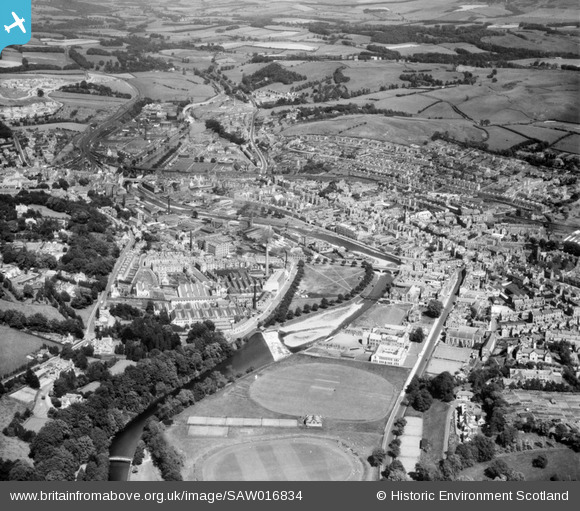
SAW016834 SCOTLAND (1948). Hawick, general view, showing Upper Common Haugh and Weensland Road. An oblique aerial photograph taken facing north-east.
© Copyright OpenStreetMap contributors and licensed by the OpenStreetMap Foundation. 2026. Cartography is licensed as CC BY-SA.
Nearby Images (7)
SAW016834

SPW042483

SAW016833

SPW042484

SAW016835

SAW016832

SAW016831

Details
| Title | [SAW016834] Hawick, general view, showing Upper Common Haugh and Weensland Road. An oblique aerial photograph taken facing north-east. |
| Reference | SAW016834 |
| Date | 1948 |
| Link | NRHE Collection item 1269046 |
| Place name | |
| Parish | HAWICK |
| District | ROXBURGH |
| Country | SCOTLAND |
| Easting / Northing | 350200, 614750 |
| Longitude / Latitude | -2.7869136562609, 55.424099253857 |
| National Grid Reference | NT502148 |

