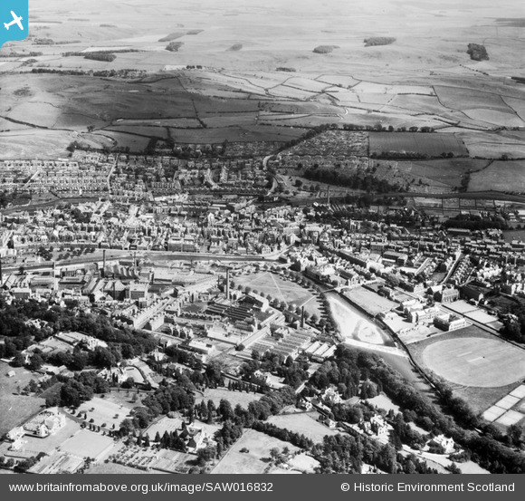
SAW016832 SCOTLAND (1948). Hawick, general view, showing Upper Common Haugh and Hawick High School, Buccleuch Road. An oblique aerial photograph taken facing south-east.
© Copyright OpenStreetMap contributors and licensed by the OpenStreetMap Foundation. 2026. Cartography is licensed as CC BY-SA.
Nearby Images (5)
Details
| Title | [SAW016832] Hawick, general view, showing Upper Common Haugh and Hawick High School, Buccleuch Road. An oblique aerial photograph taken facing south-east. |
| Reference | SAW016832 |
| Date | 1948 |
| Link | NRHE Collection item 1269044 |
| Place name | |
| Parish | HAWICK |
| District | ROXBURGH |
| Country | SCOTLAND |
| Easting / Northing | 350227, 614523 |
| Longitude / Latitude | -2.7864465250142, 55.422062232324 |
| National Grid Reference | NT502145 |
Pins

redmist |
Sunday 5th of June 2022 11:42:13 PM |


![[SAW016832] Hawick, general view, showing Upper Common Haugh and Hawick High School, Buccleuch Road. An oblique aerial photograph taken facing south-east.](http://britainfromabove.org.uk/sites/all/libraries/aerofilms-images/public/100x100/SAW/016/SAW016832.jpg)
![[SAW016835] Hawick, general view, showing Loan and Teviot Road. An oblique aerial photograph taken facing north-east.](http://britainfromabove.org.uk/sites/all/libraries/aerofilms-images/public/100x100/SAW/016/SAW016835.jpg)
![[SAW016834] Hawick, general view, showing Upper Common Haugh and Weensland Road. An oblique aerial photograph taken facing north-east.](http://britainfromabove.org.uk/sites/all/libraries/aerofilms-images/public/100x100/SAW/016/SAW016834.jpg)
![[SAW016833] Hawick, general view, showing Buccleuch Park and Langlands Road. An oblique aerial photograph taken facing east.](http://britainfromabove.org.uk/sites/all/libraries/aerofilms-images/public/100x100/SAW/016/SAW016833.jpg)
![[SPW042484] Hawick, general view, showing Upper Common Haugh and Slitrig Crescent. An oblique aerial photograph taken facing north.](http://britainfromabove.org.uk/sites/all/libraries/aerofilms-images/public/100x100/SPW/042/SPW042484.jpg)