
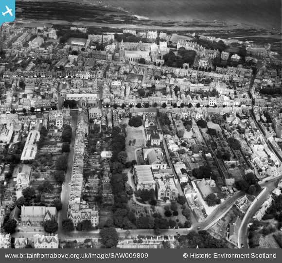
SAW009809 SCOTLAND (1947). St Andrews, general view, showing Queen's Gardens and South Street. An oblique aerial photograph taken facing north.
© Copyright OpenStreetMap contributors and licensed by the OpenStreetMap Foundation. 2026. Cartography is licensed as CC BY-SA.
Nearby Images (6)
SAW009809

SAW032131

SPW040388

SAW009812

SAW005305

SPW040384

Details
| Title | [SAW009809] St Andrews, general view, showing Queen's Gardens and South Street. An oblique aerial photograph taken facing north. |
| Reference | SAW009809 |
| Date | 1947 |
| Link | NRHE Collection item 1268652 |
| Place name | |
| Parish | ST ANDREWS AND ST LEONARDS |
| District | NORTH EAST FIFE |
| Country | SCOTLAND |
| Easting / Northing | 351021, 716588 |
| Longitude / Latitude | -2.7923647856606, 56.339204720534 |
| National Grid Reference | NO510166 |
Pins
Be the first to add a comment to this image!