
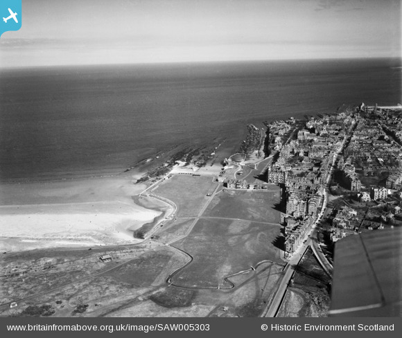
SAW005303 SCOTLAND (1947). The Old Course, The Links, St Andrews. An oblique aerial photograph taken facing east.
© Copyright OpenStreetMap contributors and licensed by the OpenStreetMap Foundation. 2026. Cartography is licensed as CC BY-SA.
Nearby Images (11)
SAW005303

SPW040391

SAW022549

SAW022547

SAR018835

SAW022546

SAW022548

SAW022550

SAW024473

SAW005302

SAW005304

Details
| Title | [SAW005303] The Old Course, The Links, St Andrews. An oblique aerial photograph taken facing east. |
| Reference | SAW005303 |
| Date | 1947 |
| Link | NRHE Collection item 1268527 |
| Place name | |
| Parish | ST ANDREWS AND ST LEONARDS |
| District | NORTH EAST FIFE |
| Country | SCOTLAND |
| Easting / Northing | 350420, 717230 |
| Longitude / Latitude | -2.8022075137738, 56.344910146193 |
| National Grid Reference | NO504172 |
Pins

Matt Aldred edob.mattaldred.com |
Sunday 23rd of January 2022 08:21:16 PM |