
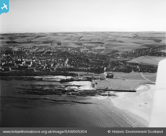
SAW005304 SCOTLAND (1947). St Andrews, general view, showing Royal and Ancient Golf Club and St Salvator's College Church, North Street. An oblique aerial photograph taken facing south.
© Copyright OpenStreetMap contributors and licensed by the OpenStreetMap Foundation. 2026. Cartography is licensed as CC BY-SA.
Nearby Images (12)
SAW005304

SAW009813

SPW020135

SAW024473

SAW022545

SPW040386

SAW022547

SAR018835

SAW022546

SAW022548

SAW022550

SAW005303

Details
| Title | [SAW005304] St Andrews, general view, showing Royal and Ancient Golf Club and St Salvator's College Church, North Street. An oblique aerial photograph taken facing south. |
| Reference | SAW005304 |
| Date | 1947 |
| Link | NRHE Collection item 1268529 |
| Place name | |
| Parish | ST ANDREWS AND ST LEONARDS |
| District | NORTH EAST FIFE |
| Country | SCOTLAND |
| Easting / Northing | 350633, 717014 |
| Longitude / Latitude | -2.7987209876562, 56.342991778021 |
| National Grid Reference | NO506170 |
Pins
Be the first to add a comment to this image!