
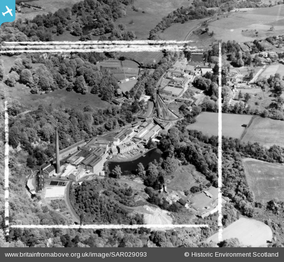
SAR029093 SCOTLAND (1957). Colinton, Currie, Midlothian, Scotland. An oblique aerial photograph taken facing South/West.
© Copyright OpenStreetMap contributors and licensed by the OpenStreetMap Foundation. 2026. Cartography is licensed as CC BY-SA.
Nearby Images (6)
SAR029093

SPW040175

SPW040177

SPW040178

SAR010319

SPW040180

Details
| Title | [SAR029093] Colinton, Currie, Midlothian, Scotland. An oblique aerial photograph taken facing South/West. |
| Reference | SAR029093 |
| Date | 1957 |
| Link | NRHE Collection item 1438505 |
| Place name | |
| Parish | CURRIE |
| District | CITY OF EDINBURGH |
| Country | SCOTLAND |
| Easting / Northing | 318950, 667970 |
| Longitude / Latitude | -3.2963052669466, 55.898054696293 |
| National Grid Reference | NT190680 |
Pins
Be the first to add a comment to this image!
User Comment Contributions
The above image looks more like Polton Mill on the river North Esk than the Water of Leith . The shape of the valley at Colinton is completely different as it is quite wide at this point. |

Alastair Charles |
Monday 20th of July 2015 07:22:40 PM |