
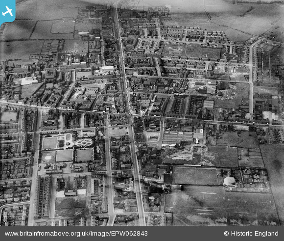
EPW062843 ENGLAND (1939). The town centre, Denton, 1939
© Copyright OpenStreetMap contributors and licensed by the OpenStreetMap Foundation. 2026. Cartography is licensed as CC BY-SA.
Nearby Images (9)
EPW062843

EPW062848

EPW029890

EPW062846

EPW029888

EPW029889

EPW062842

EPW062844

EPW062849

Details
| Title | [EPW062843] The town centre, Denton, 1939 |
| Reference | EPW062843 |
| Date | 30-August-1939 |
| Link | |
| Place name | DENTON |
| Parish | |
| District | |
| Country | ENGLAND |
| Easting / Northing | 392581, 395511 |
| Longitude / Latitude | -2.1117408742618, 53.456045871273 |
| National Grid Reference | SJ926955 |
Pins

Ray Jones |
Saturday 16th of November 2024 01:03:27 PM | |

Simon-DWCC |
Saturday 22nd of November 2014 12:20:05 PM |