
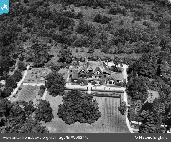
EPW062770 ENGLAND (1939). The Grove, Camberley, 1939
© Copyright OpenStreetMap contributors and licensed by the OpenStreetMap Foundation. 2026. Cartography is licensed as CC BY-SA.
Nearby Images (9)
EPW062770

EPW062763

EPW062766

EPW062762

EPW062765

EPW062768

EPW062764

EPW062767

EPW062769

Details
| Title | [EPW062770] The Grove, Camberley, 1939 |
| Reference | EPW062770 |
| Date | 23-August-1939 |
| Link | |
| Place name | CAMBERLEY |
| Parish | |
| District | |
| Country | ENGLAND |
| Easting / Northing | 489426, 161922 |
| Longitude / Latitude | -0.71577421855884, 51.348831763489 |
| National Grid Reference | SU894619 |
Pins
Be the first to add a comment to this image!