
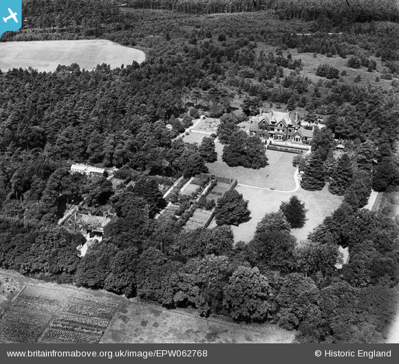
EPW062768 ENGLAND (1939). The Grove and environs, Camberley, 1939
© Copyright OpenStreetMap contributors and licensed by the OpenStreetMap Foundation. 2026. Cartography is licensed as CC BY-SA.
Nearby Images (9)
EPW062768

EPW062765

EPW062762

EPW062767

EPW062769

EPW062764

EPW062766

EPW062770

EPW062763

Details
| Title | [EPW062768] The Grove and environs, Camberley, 1939 |
| Reference | EPW062768 |
| Date | 23-August-1939 |
| Link | |
| Place name | CAMBERLEY |
| Parish | |
| District | |
| Country | ENGLAND |
| Easting / Northing | 489442, 161859 |
| Longitude / Latitude | -0.71556034607424, 51.348262844749 |
| National Grid Reference | SU894619 |
Pins

markhortonphotography |
Monday 27th of January 2014 07:20:47 PM |