
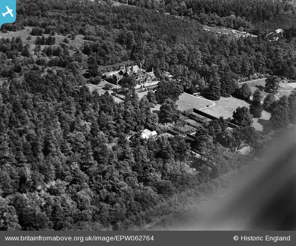
EPW062764 ENGLAND (1939). The Grove and environs, Camberley, 1939
© Copyright OpenStreetMap contributors and licensed by the OpenStreetMap Foundation. 2026. Cartography is licensed as CC BY-SA.
Nearby Images (9)
EPW062764

EPW062768

EPW062762

EPW062765

EPW062766

EPW062769

EPW062767

EPW062763

EPW062770

Details
| Title | [EPW062764] The Grove and environs, Camberley, 1939 |
| Reference | EPW062764 |
| Date | 23-August-1939 |
| Link | |
| Place name | CAMBERLEY |
| Parish | |
| District | |
| Country | ENGLAND |
| Easting / Northing | 489417, 161849 |
| Longitude / Latitude | -0.71592177709934, 51.348176875028 |
| National Grid Reference | SU894618 |
Pins

markhortonphotography |
Monday 27th of January 2014 07:20:01 PM | |
|
Media Technician |
Sunday 26th of January 2014 07:42:49 AM |
User Comment Contributions
This is now the site of Collingwood College The main building is near the 6th Form Centre car park and F block |
Media Technician |
Sunday 26th of January 2014 07:42:31 AM |