
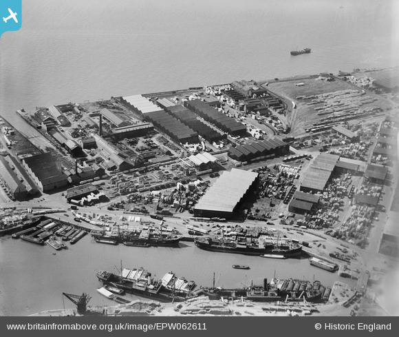
EPW062611 ENGLAND (1939). Timber Yards on Garrison Side, Kingston upon Hull, 1939
© Copyright OpenStreetMap contributors and licensed by the OpenStreetMap Foundation. 2026. Cartography is licensed as CC BY-SA.
Nearby Images (11)
EPW062611

EPW062614

EPW062613

EPW062615

EPW062612

EPW012702

EPW036528

EPW036426

EPW036437

EAW015659

EAW046138

Details
| Title | [EPW062611] Timber Yards on Garrison Side, Kingston upon Hull, 1939 |
| Reference | EPW062611 |
| Date | 9-August-1939 |
| Link | |
| Place name | KINGSTON UPON HULL |
| Parish | |
| District | |
| Country | ENGLAND |
| Easting / Northing | 510669, 428565 |
| Longitude / Latitude | -0.32181915336891, 53.741481382568 |
| National Grid Reference | TA107286 |
Pins

John Wass |
Saturday 14th of February 2015 02:10:55 PM | |
|
John Wass |
Saturday 14th of February 2015 02:08:03 PM | |
|
John Wass |
Saturday 14th of February 2015 02:07:03 PM |