
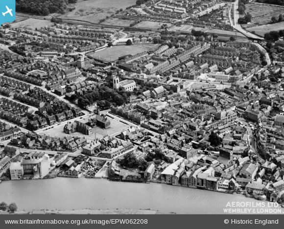
EPW062208 ENGLAND (1939). All Saints' Church and environs, Gainsborough, 1939. This image has been produced from a copy-negative.
© Copyright OpenStreetMap contributors and licensed by the OpenStreetMap Foundation. 2026. Cartography is licensed as CC BY-SA.
Nearby Images (6)
EPW062208

EPW062209

EPW016159

EPW013935

EPW016161

EAW025211

Details
| Title | [EPW062208] All Saints' Church and environs, Gainsborough, 1939. This image has been produced from a copy-negative. |
| Reference | EPW062208 |
| Date | 4-July-1939 |
| Link | |
| Place name | GAINSBOROUGH |
| Parish | GAINSBOROUGH |
| District | |
| Country | ENGLAND |
| Easting / Northing | 481422, 390010 |
| Longitude / Latitude | -0.77524169810076, 53.400365540447 |
| National Grid Reference | SK814900 |
Pins

Bert |
Sunday 20th of July 2025 07:30:51 PM |