
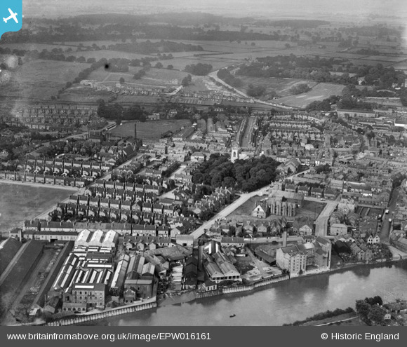
EPW016161 ENGLAND (1926). All Saints' Church and the Old Hall, Gainsborough, from the west, 1926
© Copyright OpenStreetMap contributors and licensed by the OpenStreetMap Foundation. 2026. Cartography is licensed as CC BY-SA.
Nearby Images (5)
EPW016161

EPW062209

EPW016159

EAW025211

EPW062208

Details
| Title | [EPW016161] All Saints' Church and the Old Hall, Gainsborough, from the west, 1926 |
| Reference | EPW016161 |
| Date | 2-July-1926 |
| Link | |
| Place name | GAINSBOROUGH |
| Parish | GAINSBOROUGH |
| District | |
| Country | ENGLAND |
| Easting / Northing | 481222, 390041 |
| Longitude / Latitude | -0.77824138604645, 53.40067496922 |
| National Grid Reference | SK812900 |
Pins

JB1404 |
Tuesday 19th of April 2016 06:14:24 PM | |
|
Ian |
Friday 16th of May 2014 11:15:17 AM | |
|
Ian |
Friday 16th of May 2014 11:03:21 AM | |
|
Ian |
Friday 16th of May 2014 11:00:46 AM | |
|
Paddy Buckley |
Sunday 21st of October 2012 12:05:24 PM | |
|
Paddy Buckley |
Sunday 21st of October 2012 12:01:51 PM | |
|
Paddy Buckley |
Sunday 21st of October 2012 12:01:05 PM | |
|
Paddy Buckley |
Sunday 21st of October 2012 11:52:09 AM | |
|
kevin_s |
Monday 9th of July 2012 06:33:49 PM |


User Comment Contributions
Rose forgrove is to the bottom left |
Bones_63 |
Tuesday 19th of April 2016 08:48:25 PM |