
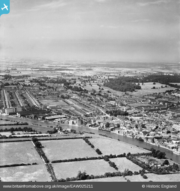
EAW025211 ENGLAND (1949). The town, Gainsborough, from the south, 1949
© Copyright OpenStreetMap contributors and licensed by the OpenStreetMap Foundation. 2026. Cartography is licensed as CC BY-SA.
Nearby Images (5)
EAW025211

EPW016159

EPW016161

EPW062209

EPW062208

Details
| Title | [EAW025211] The town, Gainsborough, from the south, 1949 |
| Reference | EAW025211 |
| Date | 26-July-1949 |
| Link | |
| Place name | GAINSBOROUGH |
| Parish | GAINSBOROUGH |
| District | |
| Country | ENGLAND |
| Easting / Northing | 481231, 389859 |
| Longitude / Latitude | -0.77815290515515, 53.399037847022 |
| National Grid Reference | SK812899 |
Pins
Be the first to add a comment to this image!