
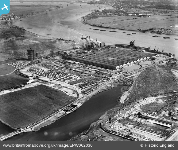
EPW062036 ENGLAND (1939). The Ford Motor Car Manufactory, Dagenham, 1939
© Copyright OpenStreetMap contributors and licensed by the OpenStreetMap Foundation. 2026. Cartography is licensed as CC BY-SA.
Nearby Images (32)
EPW062036

EAW029518

EPW060999

EAW000072

EPW061001

EAW041029

EAW029513

EPW009956

EAW029519

EAW022777

EAW029515

EPW055195

EAW029516

EPW046938

EAW022767

EAW053040

EPW060997

EAW022774

EPW061005

EAW029517

EAW041033

EAW053051

EAW000070

EAW029521

EAW029514

EPW009954

EAW022764

EPW055260

EPW046939

EAW041030

EPW055161

EPW062033

Details
| Title | [EPW062036] The Ford Motor Car Manufactory, Dagenham, 1939 |
| Reference | EPW062036 |
| Date | 27-June-1939 |
| Link | |
| Place name | DAGENHAM |
| Parish | |
| District | |
| Country | ENGLAND |
| Easting / Northing | 549518, 182015 |
| Longitude / Latitude | 0.15515415253151, 51.516760202627 |
| National Grid Reference | TQ495820 |
Pins
Be the first to add a comment to this image!