
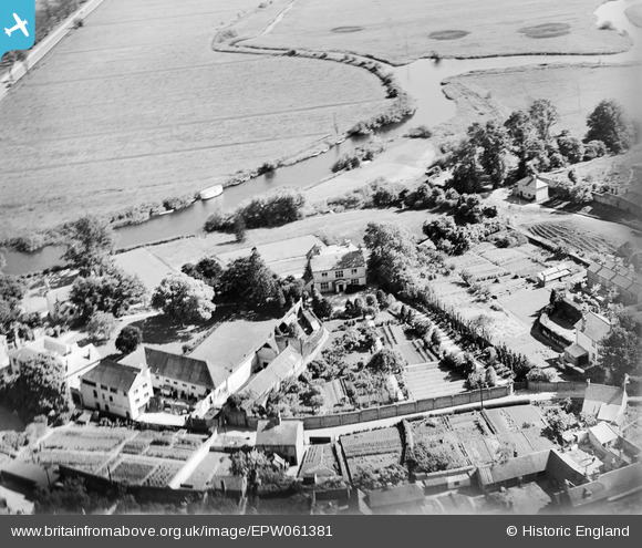
EPW061381 ENGLAND (1939). Castle Close, Pound Lane and environs, Wareham, 1939
© Copyright OpenStreetMap contributors and licensed by the OpenStreetMap Foundation. 2026. Cartography is licensed as CC BY-SA.
Nearby Images (12)
EPW061381

EPW061380

EPW061379

EPW061382

EPW061385

EPW061383

EPW061384

EPW032294

EPW013663

EPW013661

EAW018159

EPW032295

Details
| Title | [EPW061381] Castle Close, Pound Lane and environs, Wareham, 1939 |
| Reference | EPW061381 |
| Date | 4-June-1939 |
| Link | |
| Place name | WAREHAM |
| Parish | WAREHAM TOWN |
| District | |
| Country | ENGLAND |
| Easting / Northing | 392182, 87183 |
| Longitude / Latitude | -2.1106756110207, 50.683671915992 |
| National Grid Reference | SY922872 |
Pins
Be the first to add a comment to this image!