
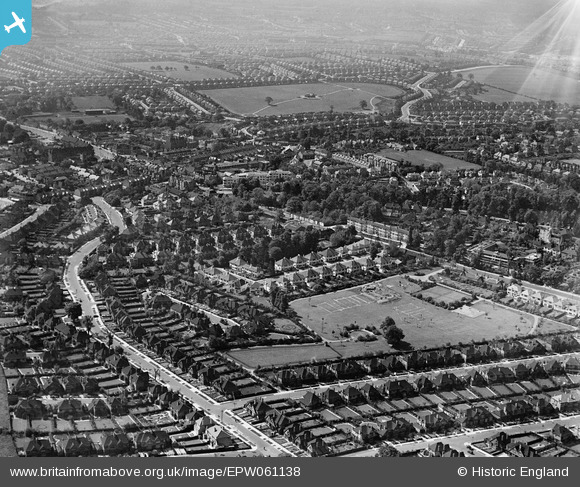
EPW061138 ENGLAND (1939). Stonegrove Park, Green Lane and environs, Edgware, from the north, 1939
© Copyright OpenStreetMap contributors and licensed by the OpenStreetMap Foundation. 2026. Cartography is licensed as CC BY-SA.
Nearby Images (10)
EPW061138

EPW034548

EPW034547

EPW034623

EAW027667
 in flight over the Broadfields Avenue area, Edgware, from the south-west, 1949")
EPW034556

EPW034550

EPW034619

EPW034551

EPW034621

Details
| Title | [EPW061138] Stonegrove Park, Green Lane and environs, Edgware, from the north, 1939 |
| Reference | EPW061138 |
| Date | 30-May-1939 |
| Link | |
| Place name | EDGWARE |
| Parish | |
| District | |
| Country | ENGLAND |
| Easting / Northing | 519042, 192074 |
| Longitude / Latitude | -0.28047963684097, 51.614420512274 |
| National Grid Reference | TQ190921 |
Pins

Matt Aldred edob.mattaldred.com |
Wednesday 19th of April 2023 09:33:55 PM | |

mc52 |
Wednesday 9th of July 2014 10:31:11 PM | |

Class31 |
Friday 21st of February 2014 12:45:09 PM | |
|
colsouth111 |
Wednesday 28th of August 2013 01:51:30 PM |
