
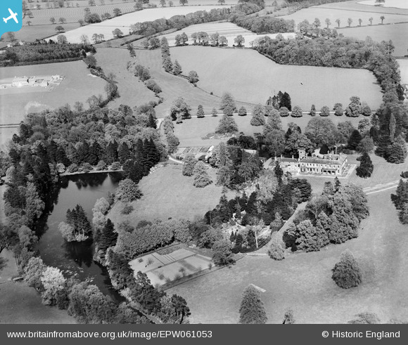
EPW061053 ENGLAND (1939). Wergs Hall and surrounding countryside, Codsall, 1939
© Copyright OpenStreetMap contributors and licensed by the OpenStreetMap Foundation. 2026. Cartography is licensed as CC BY-SA.
Nearby Images (7)
EPW061053

EPW061048

EPW061051

EPW061050

EPW061052

EPW061054

EPW061047

Details
| Title | [EPW061053] Wergs Hall and surrounding countryside, Codsall, 1939 |
| Reference | EPW061053 |
| Date | 10-May-1939 |
| Link | |
| Place name | CODSALL |
| Parish | CODSALL |
| District | |
| Country | ENGLAND |
| Easting / Northing | 386892, 301450 |
| Longitude / Latitude | -2.1936003591708, 52.610315778429 |
| National Grid Reference | SJ869015 |
Pins

totoro |
Friday 20th of June 2014 08:21:50 PM | |
|
totoro |
Friday 20th of June 2014 08:19:53 PM |