
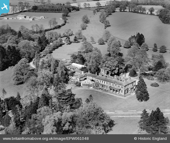
EPW061048 ENGLAND (1939). Wergs Hall, Codsall, 1939
© Copyright OpenStreetMap contributors and licensed by the OpenStreetMap Foundation. 2026. Cartography is licensed as CC BY-SA.
Nearby Images (7)
EPW061048

EPW061053

EPW061054

EPW061051

EPW061052

EPW061050

EPW061047

Details
| Title | [EPW061048] Wergs Hall, Codsall, 1939 |
| Reference | EPW061048 |
| Date | 10-May-1939 |
| Link | |
| Place name | CODSALL |
| Parish | CODSALL |
| District | |
| Country | ENGLAND |
| Easting / Northing | 386921, 301424 |
| Longitude / Latitude | -2.1931710137938, 52.61008271792 |
| National Grid Reference | SJ869014 |
Pins
User Comment Contributions
Codsall, Staffordshire WV8 2HG Constructed in the mid 1800′s as an Iron Master’s house. Grade 2 listed building - English Heritage Building ID: 271448 Country House now offices, c1840, renovated and refurbished in mid C20 The site now looks quite different to the BfA image. Most recently the building has been used as offices. The hall itself has been converted into 6 luxury apartments. A modern wing attached to the house has been demolished and replaced with 19 apartments. A former amenity block on the site, was also demolished and replaced by 18 apartments built in a courtyard setting |

totoro |
Tuesday 28th of January 2014 06:15:50 PM |