
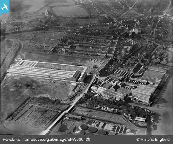
EPW060439 ENGLAND (1939). The British Fibrocement Works and environs, Erith, 1939
© Copyright OpenStreetMap contributors and licensed by the OpenStreetMap Foundation. 2026. Cartography is licensed as CC BY-SA.
Nearby Images (18)
EPW060439

EPW060441

EPW060443

EPW060438

EPW060446

EPW060440

EPW060442

EPW060444

EPW060435

EPW060437

EPW060436

EPW045628

EPW060445

EPW060434

EPW045625

EPW045622

EPW045624

EPW045627

Details
| Title | [EPW060439] The British Fibrocement Works and environs, Erith, 1939 |
| Reference | EPW060439 |
| Date | 6-February-1939 |
| Link | |
| Place name | ERITH |
| Parish | |
| District | |
| Country | ENGLAND |
| Easting / Northing | 551993, 177686 |
| Longitude / Latitude | 0.18893603218558, 51.477199493493 |
| National Grid Reference | TQ520777 |
Pins
Be the first to add a comment to this image!