
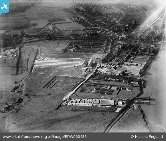
EPW060436 ENGLAND (1939). The British Fibrocement Works and environs, Erith, 1939
© Copyright OpenStreetMap contributors and licensed by the OpenStreetMap Foundation. 2026. Cartography is licensed as CC BY-SA.
Nearby Images (17)
EPW060436

EPW060442

EPW060446

EPW060440

EPW060438

EPW060441

EPW060437

EPW060435

EPW060439

EPW060444

EPW060445

EPW045628

EPW060443

EPW045625

EPW060434

EPW045624

EPW045622

Details
| Title | [EPW060436] The British Fibrocement Works and environs, Erith, 1939 |
| Reference | EPW060436 |
| Date | 6-February-1939 |
| Link | |
| Place name | ERITH |
| Parish | |
| District | |
| Country | ENGLAND |
| Easting / Northing | 552116, 177668 |
| Longitude / Latitude | 0.19069828000266, 51.477004680668 |
| National Grid Reference | TQ521777 |
Pins

Barney |
Tuesday 8th of January 2019 01:28:19 PM | |
|
Barney |
Tuesday 8th of January 2019 01:27:47 PM | |
 |

Mike Floate |
Tuesday 24th of December 2013 07:14:14 PM |