
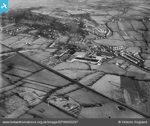
EPW060297 ENGLAND (1938). British Insulated Cable Works, Helsby, 1938
© Copyright OpenStreetMap contributors and licensed by the OpenStreetMap Foundation. 2026. Cartography is licensed as CC BY-SA.
Nearby Images (39)
EPW060297

EPW062722

EPW060300

EPW062724

EAW015878

EPW060294

EAW021976

EAW015880
, Helsby, 1948. This image has been produced from a damaged negative.")
EPW057913

EPW062727

EPW057907

EPW060295

EPW057910

EPW060299

EPW057908

EPW062725

EAW015879

EPW060293

EPW060291

EAW021977

EPW060292

EPW062726

EPW060290

EAW021975

EPW060296

EPW036904

EPW036903

EPW062723

EPW036905

EPW036906

EAW021973

EPW029587

EAW021978

EPW060298

EAW021974

EAW021979

EAW021980

EAW021972

EPW060301

Details
| Title | [EPW060297] British Insulated Cable Works, Helsby, 1938 |
| Reference | EPW060297 |
| Date | 14-December-1938 |
| Link | |
| Place name | HELSBY |
| Parish | HELSBY |
| District | |
| Country | ENGLAND |
| Easting / Northing | 348340, 374700 |
| Longitude / Latitude | -2.7746357231012, 53.266498035612 |
| National Grid Reference | SJ483747 |
Pins
Be the first to add a comment to this image!