
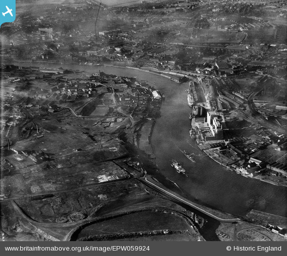
EPW059924 ENGLAND (1938). The Tyne Flour Mill, the River Tyne and Salt Meadows, Gateshead, 1938
© Copyright OpenStreetMap contributors and licensed by the OpenStreetMap Foundation. 2026. Cartography is licensed as CC BY-SA.
Nearby Images (8)
EPW059924

EAW037003
 moored on the River Tyne opposite the South Shore Road Engineering Works, Byker, 1951. This image has been produced from a print.")
EPW059919

EPW059921

EAW037007
 moored on the River Tyne and the area around St Lawrence Park, Byker, 1951. This image has been produced from a print.")
EAW037006
 moored on the River Tyne, Byker, 1951. This image has been produced from a print.")
EAW037004
 moored on the River Tyne near the Tyne Mill, Byker, 1951. This image has been produced from a print.")
EAW037005
 moored on the River Tyne near the Tyne Mill, Byker, 1951. This image has been produced from a print.")
Details
| Title | [EPW059924] The Tyne Flour Mill, the River Tyne and Salt Meadows, Gateshead, 1938 |
| Reference | EPW059924 |
| Date | 11-October-1938 |
| Link | |
| Place name | GATESHEAD |
| Parish | |
| District | |
| Country | ENGLAND |
| Easting / Northing | 426661, 563622 |
| Longitude / Latitude | -1.5835230125831, 54.966433035326 |
| National Grid Reference | NZ267636 |
Pins
Be the first to add a comment to this image!