
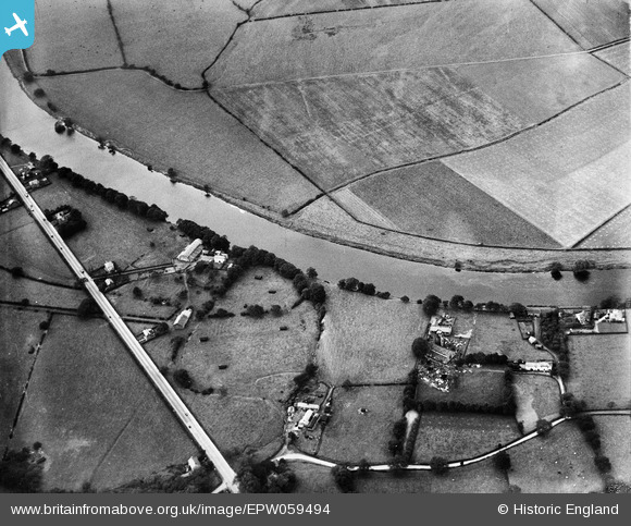
EPW059494 ENGLAND (1938). The River Ribble between Gregson's Farm and St Leonard's Church, Samlesbury, 1938
© Copyright OpenStreetMap contributors and licensed by the OpenStreetMap Foundation. 2025. Cartography is licensed as CC BY-SA.
Nearby Images (3)
EPW059494

EPW059500

EPW059506

Details
| Title | [EPW059494] The River Ribble between Gregson's Farm and St Leonard's Church, Samlesbury, 1938 |
| Reference | EPW059494 |
| Date | 22-September-1938 |
| Link | |
| Place name | SAMLESBURY |
| Parish | SAMLESBURY |
| District | |
| Country | ENGLAND |
| Easting / Northing | 358807, 430345 |
| Longitude / Latitude | -2.6250138044526, 53.767601990271 |
| National Grid Reference | SD588303 |
Pins
Be the first to add a comment to this image!