
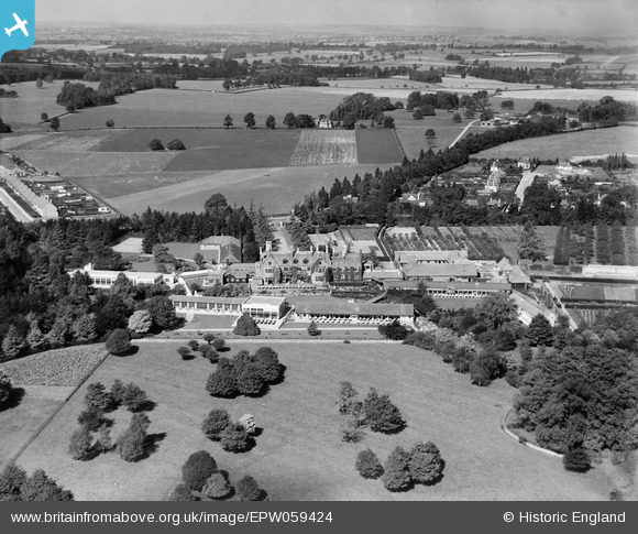
EPW059424 ENGLAND (1938). The Manfield Orthopaedic Hospital, Northampton, from the south-east, 1938
© Copyright OpenStreetMap contributors and licensed by the OpenStreetMap Foundation. 2025. Cartography is licensed as CC BY-SA.
Nearby Images (8)
EPW059424

EPW059417

EPW059418

EPW059423

EPW059422

EPW059421

EPW059419

EPW059420

Details
| Title | [EPW059424] The Manfield Orthopaedic Hospital, Northampton, from the south-east, 1938 |
| Reference | EPW059424 |
| Date | 13-September-1938 |
| Link | |
| Place name | NORTHAMPTON |
| Parish | |
| District | |
| Country | ENGLAND |
| Easting / Northing | 477789, 263580 |
| Longitude / Latitude | -0.86002646948906, 52.264479205643 |
| National Grid Reference | SP778636 |
Pins
 |

foep.vic |
Tuesday 8th of December 2015 09:40:02 PM |
 |
foep.vic |
Tuesday 8th of December 2015 09:37:50 PM |
|
foep.vic |
Tuesday 8th of December 2015 09:11:26 PM | |
|
foep.vic |
Tuesday 8th of December 2015 09:07:40 PM |
User Comment Contributions
The area in the foreground is now part of Eastfield Park (Northampton) with Manfield Grange, a private development, in the middle distance. |
foep.vic |
Tuesday 8th of December 2015 09:35:51 PM |