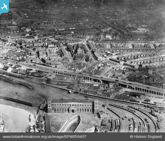
EPW059407 ENGLAND (1938). The Silvertown Way Viaduct, St Luke's Church and the surrounding residential area, Canning Town, 1938
© Copyright OpenStreetMap contributors and licensed by the OpenStreetMap Foundation. 2026. Cartography is licensed as CC BY-SA.
Nearby Images (7)
Details
| Title | [EPW059407] The Silvertown Way Viaduct, St Luke's Church and the surrounding residential area, Canning Town, 1938 |
| Reference | EPW059407 |
| Date | 15-September-1938 |
| Link | |
| Place name | CANNING TOWN |
| Parish | |
| District | |
| Country | ENGLAND |
| Easting / Northing | 539777, 181003 |
| Longitude / Latitude | 0.014442545390423, 51.510160170661 |
| National Grid Reference | TQ398810 |
Pins

Chris |
Sunday 15th of August 2021 01:14:32 PM | |

Chris |
Sunday 15th of August 2021 01:14:00 PM | |

Chris |
Sunday 15th of August 2021 01:13:35 PM | |

Chris |
Sunday 15th of August 2021 01:13:15 PM | |

Grollo |
Wednesday 9th of December 2020 06:32:38 AM | |

Hermann the German |
Wednesday 11th of October 2017 12:56:51 PM | |

Hermann the German |
Wednesday 11th of October 2017 12:49:56 PM | |

Hermann the German |
Wednesday 11th of October 2017 12:43:45 PM | |

Hermann the German |
Wednesday 11th of October 2017 12:42:53 PM | |

Hermann the German |
Wednesday 11th of October 2017 12:31:37 PM | |

Class31 |
Monday 16th of March 2015 02:36:04 PM | |

sarahearney |
Sunday 28th of July 2013 05:04:47 PM |


![[EPW059407] The Silvertown Way Viaduct, St Luke's Church and the surrounding residential area, Canning Town, 1938](http://britainfromabove.org.uk/sites/all/libraries/aerofilms-images/public/100x100/EPW/059/EPW059407.jpg)
![[EPW040854] Slum clearance off the Victoria Dock Road and environs, Canning Town, 1933](http://britainfromabove.org.uk/sites/all/libraries/aerofilms-images/public/100x100/EPW/040/EPW040854.jpg)
![[EPW040853] Slum clearance off the Victoria Dock Road and environs, Canning Town, 1933](http://britainfromabove.org.uk/sites/all/libraries/aerofilms-images/public/100x100/EPW/040/EPW040853.jpg)
![[EPW046798] A cityscape over the River Thames and the Isle of Dogs, Canning Town, from the north-east, 1935](http://britainfromabove.org.uk/sites/all/libraries/aerofilms-images/public/100x100/EPW/046/EPW046798.jpg)
![[EPW059453] The Thames Wharf and environs, Canning Town, 1938](http://britainfromabove.org.uk/sites/all/libraries/aerofilms-images/public/100x100/EPW/059/EPW059453.jpg)
![[EPW059455] Thames Wharf and the surrounding residential area, Canning Town, 1938](http://britainfromabove.org.uk/sites/all/libraries/aerofilms-images/public/100x100/EPW/059/EPW059455.jpg)
![[EPW040852] Slum clearance off the Victoria Dock Road and environs, Canning Town, 1933](http://britainfromabove.org.uk/sites/all/libraries/aerofilms-images/public/100x100/EPW/040/EPW040852.jpg)