
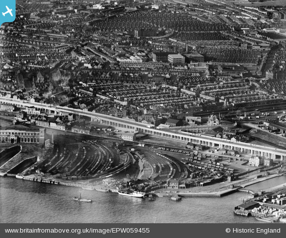
EPW059455 ENGLAND (1938). Thames Wharf and the surrounding residential area, Canning Town, 1938
© Copyright OpenStreetMap contributors and licensed by the OpenStreetMap Foundation. 2026. Cartography is licensed as CC BY-SA.
Nearby Images (6)
EPW059455

EPW040853

EPW059453

EPW059407

EPW040854

EAW009064

Details
| Title | [EPW059455] Thames Wharf and the surrounding residential area, Canning Town, 1938 |
| Reference | EPW059455 |
| Date | 15-September-1938 |
| Link | |
| Place name | CANNING TOWN |
| Parish | |
| District | |
| Country | ENGLAND |
| Easting / Northing | 539903, 180853 |
| Longitude / Latitude | 0.016197700418847, 51.508780944195 |
| National Grid Reference | TQ399809 |
Pins

Del |
Friday 26th of May 2023 01:46:07 PM | |
|
Del |
Friday 26th of May 2023 01:42:18 PM | |
|
sarahearney |
Sunday 28th of July 2013 05:05:52 PM |