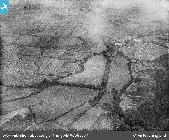
EPW059257 ENGLAND (1938). The Rother Light Railway Line and surrounding countryside at Junction Road Halt, Udiam, 1938
© Copyright OpenStreetMap contributors and licensed by the OpenStreetMap Foundation. 2026. Cartography is licensed as CC BY-SA.
Details
| Title | [EPW059257] The Rother Light Railway Line and surrounding countryside at Junction Road Halt, Udiam, 1938 |
| Reference | EPW059257 |
| Date | 11-September-1938 |
| Link | |
| Place name | UDIAM |
| Parish | EWHURST |
| District | |
| Country | ENGLAND |
| Easting / Northing | 576850, 124267 |
| Longitude / Latitude | 0.52019316834421, 50.990052050846 |
| National Grid Reference | TQ769243 |
Pins

Railway Routes |
Saturday 27th of February 2021 04:44:18 PM | |

Railway Routes |
Saturday 27th of February 2021 04:43:54 PM | |

Railway Routes |
Saturday 27th of February 2021 04:43:41 PM |


![[EPW059257] The Rother Light Railway Line and surrounding countryside at Junction Road Halt, Udiam, 1938](http://britainfromabove.org.uk/sites/all/libraries/aerofilms-images/public/100x100/EPW/059/EPW059257.jpg)
![[EPW059577] Countryside around Udiam and the River Rother, Bodiam, from the west, 1938](http://britainfromabove.org.uk/sites/all/libraries/aerofilms-images/public/100x100/EPW/059/EPW059577.jpg)
![[EPW059570] Fowlbrook Wood and Junction Road looking towards Knowl Hill, Salehurst, from the south-west, 1938](http://britainfromabove.org.uk/sites/all/libraries/aerofilms-images/public/100x100/EPW/059/EPW059570.jpg)