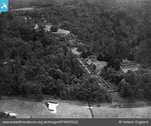
EPW059221 ENGLAND (1938). Sefton and surrounding woodland, St George's Hill, 1938
© Copyright OpenStreetMap contributors and licensed by the OpenStreetMap Foundation. 2026. Cartography is licensed as CC BY-SA.
Nearby Images (7)
Details
| Title | [EPW059221] Sefton and surrounding woodland, St George's Hill, 1938 |
| Reference | EPW059221 |
| Date | 11-September-1938 |
| Link | |
| Place name | ST GEORGE'S HILL |
| Parish | |
| District | |
| Country | ENGLAND |
| Easting / Northing | 508375, 162541 |
| Longitude / Latitude | -0.44356191267162, 51.351097886032 |
| National Grid Reference | TQ084625 |
Pins
Be the first to add a comment to this image!


![[EPW059221] Sefton and surrounding woodland, St George's Hill, 1938](http://britainfromabove.org.uk/sites/all/libraries/aerofilms-images/public/100x100/EPW/059/EPW059221.jpg)
![[EPW059220] Sefton and surrounding woodland and properties, St George's Hill, 1938](http://britainfromabove.org.uk/sites/all/libraries/aerofilms-images/public/100x100/EPW/059/EPW059220.jpg)
![[EPW059219] Sefton and surrounding woodland and properties, St George's Hill, 1938](http://britainfromabove.org.uk/sites/all/libraries/aerofilms-images/public/100x100/EPW/059/EPW059219.jpg)
![[EPW059222] Sefton and surrounding woodland and properties, St George's Hill, 1938](http://britainfromabove.org.uk/sites/all/libraries/aerofilms-images/public/100x100/EPW/059/EPW059222.jpg)
![[EPW059223] Sefton and surrounding woodland and properties, St George's Hill, 1938](http://britainfromabove.org.uk/sites/all/libraries/aerofilms-images/public/100x100/EPW/059/EPW059223.jpg)
![[EPW059224] Sefton, St George's Hill, 1938](http://britainfromabove.org.uk/sites/all/libraries/aerofilms-images/public/100x100/EPW/059/EPW059224.jpg)
![[EPW059225] Sefton, St George's Hill, 1938. This image has been produced from a damaged negative.](http://britainfromabove.org.uk/sites/all/libraries/aerofilms-images/public/100x100/EPW/059/EPW059225.jpg)